Posts

Showing posts with the label Map

Autumnal Equinox 2016 as seen from Space (animated)

Image
An Equinox is the astronomical event when both the hemispheres have equal duration and amount of sunshine. Sun would be exactly overhead of the equator. It happens twice in a year Spring (Summer) equinox (20 March) and Vernal (Autumnal) equinox (22 September) . Here is the view of the beautiful event from space for 22 September 2016. I have animated it (time series for the day). Watch the day-night solar terminator move through the earth. Observe the equal area of sunshine and night on either hemisphere. The visible imagery is from MeteoSat VISSR (IODC) stationed at 57deg.E longitude above equator in a geostationary orbit. For a typical comparison of Equinoxes with Solistices, you may go through this link http://akmnscience.blogspot.in/2012/07/equinox-solstice-better-view.html Image Courtesy: Dundee Satellite Receiving Station http://www.sat.dundee.ac.uk/

Satellite Images - Easy to interpret

Image
Satellite images are are rich with useful and interesting information. It is not difficult to interpret them... here are some tips and stratergies....    They can show us how much a city has changed, how well our crops are growing, where a fire is burning, or when a storm is coming.  Here is a practical approach as given by Nasa Earth Observatory. Look for a scale Look for patterns, shapes, and textures Define the colors (including shadows) Find north Consider your prior knowledge Read more.... Check this link..... http://earthobservatory.nasa.gov/Features/ColorImage/?src=eorss-features Courtesy: Nasa Earth Observatory

Equinox & Solstice - a better view

Image
Equinox & Solstice (view from Space).  Doesn't it convey better information than the usual cartoons.....?  I have taken the Satellite images from Meteosat via. Dundee satellite Receiving Station and made the matrix using GIMP.

Don't miss to watch the 'Transit of Venus'

Image
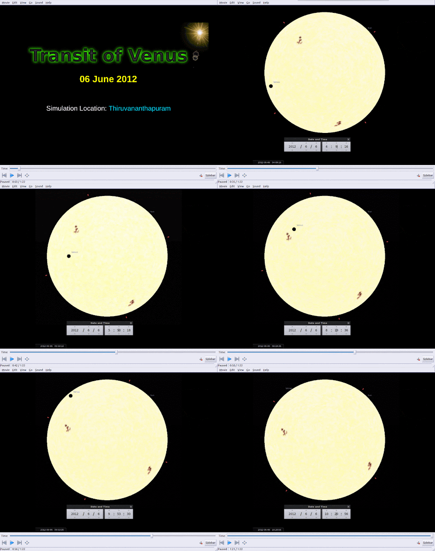
Be prepared to watch a heavenly drama on 6 June 2012. The Venus can be seen as a black dot travelling across the Solar Disk. Here is my Simulation: Yes, it is the "Transit of Venus across the Sun" Path-- L to R Credit: Michael Zeiler, eclipse-maps.com India comes under the visibility of the event after Sunrise. See the graphic below: Thiruvananthapuram can view it right from sunrise to 10:22 AM. The graphic was prepared using the tool provided in  http://transitofvenus.nl/wp/where-when/local-transit-times/   You can change the location and see about your visibility to the drama. Also read the following blog for wonderful information and graphics. http://blogs.esa.int/venustransit/        (nice and informative blog by ESA) http://eclipse-maps.com/Eclipse-Maps/Transits.html     (Transit maps) http://sunearthday.nasa.gov/transitofvenus/ You can also find how to watch the event.... Follow safe way.... take care ...

High Resolution Global Topographic Map of Moon

Image
LRO Camera Team Releases High Resolution Global Topographic Map of Moon. click on the image to go to the official website and high resolution image. Source: NASA-LRO http://www.nasa.gov/mission_pages/LRO/news/lro-topo.html

NOAA satellite Mosaic images

Image
Here is the link to see the Mapped mosaics are daily images by NOAA seeries of satellites. The data are from the AVHRR instrument on NOAA/ESA’s polar orbiting satellites (NOAA-16, 17, 18, 19, and METOP-A). Here is the link and descriptions http://www.osdpd.noaa.gov/ml/imagery/mosaics.html

Improved Topographic Map of Earth

NASA and Japan released a significantly improved version of the most complete digital topographic map of Earth. Data users can download the ASTER global digital elevation model at: https://lpdaac.usgs.gov / or http://www.ersdac.or.jp/GDEM/E/4.html . For more information about ASTER, visit: http://asterweb.jpl.nasa.gov/ . For more information on NASA's Terra mission, visit: http://www.nasa.gov/terra .